- April 24, 2024

-
-
Loading
Loading
The 8 p.m. EDT Intermediate Advisory 35A from the National Weather Service National Hurricane Center shows a slight shift west for Hurricane Irma.
The storm is expected to hit South Florida at 2 p.m. Sunday, Sept. 9. While there, NHC predicts the winds to be greater than 110 mph, which is what the “M” on the black circle signifies on the graphic above.
Irma is then expected follow the path of the black line on the graphic above, which would lead it up Florida leaning toward the East Coast, but still affecting both coasts to some degree.
Flagler County will see storm conditions between Sunday and Monday, and maybe even earlier depending on if the storm stays on its current path and rate. On Sept. 11 at 2 p.m., the center of Irma is projected to have gone further north into Georgia, and at that point have winds 74-110 mph, which is signified by the “H” in the black circle on the graphic above. Flagler County will still see storm conditions at that point, as Irma is about 400 miles wide.
Keep in mind, everything in the projected cone (with dots) is the potential track area for the storm.
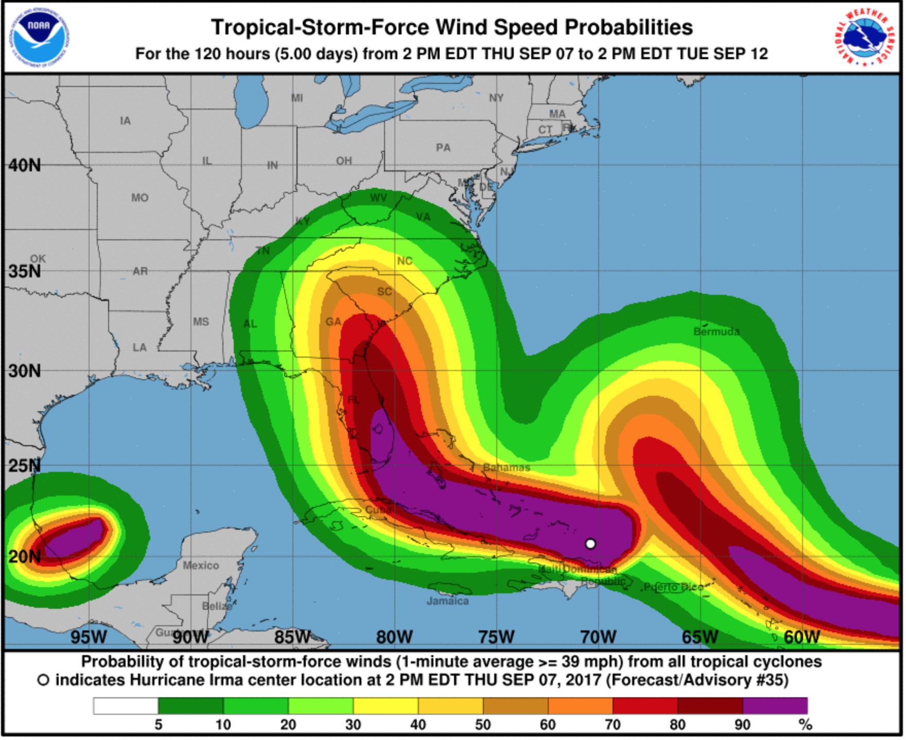
The graphic above shows the probabilities of tropical storm force winds, which are winds exceeding 39 mph, from 2 p.m. Thursday, Sept. 7 through 2 p.m. Tuesday, Sept. 12. As pictured in the graphic, the NHC predicts there is an 80% - 90% chance Flagler County will see tropical storm force winds between 2 p.m. Thursday, Sept. 7 to 2 p.m. Tuesday, Sept. 12. If the storm continues on its projected path, the likelihood Flagler County will see winds of tropical storm force or higher will continue to grow.
The NHC will continue to provide updates on Hurricane Irma at nhc.noaa.gov.