- April 26, 2024

-
-
Loading
Loading
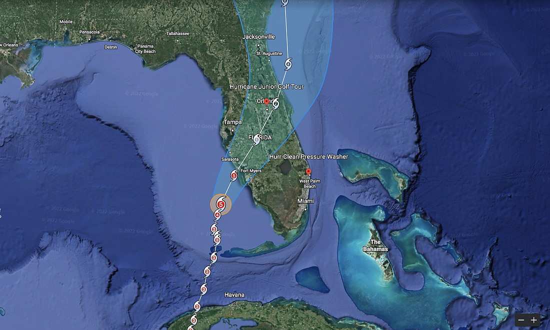
Hurricane Ian strengthened to a Category 4 overnight and was nearing category 5 strength as of Wednesday morning.
Its latest projected track has shifted southward, showing it striking the state near Port Charlotte as a Category 4 or 5, then arcing east across the peninsula and exiting near Port Orange as a tropical storm and churning north offshore along the coast.
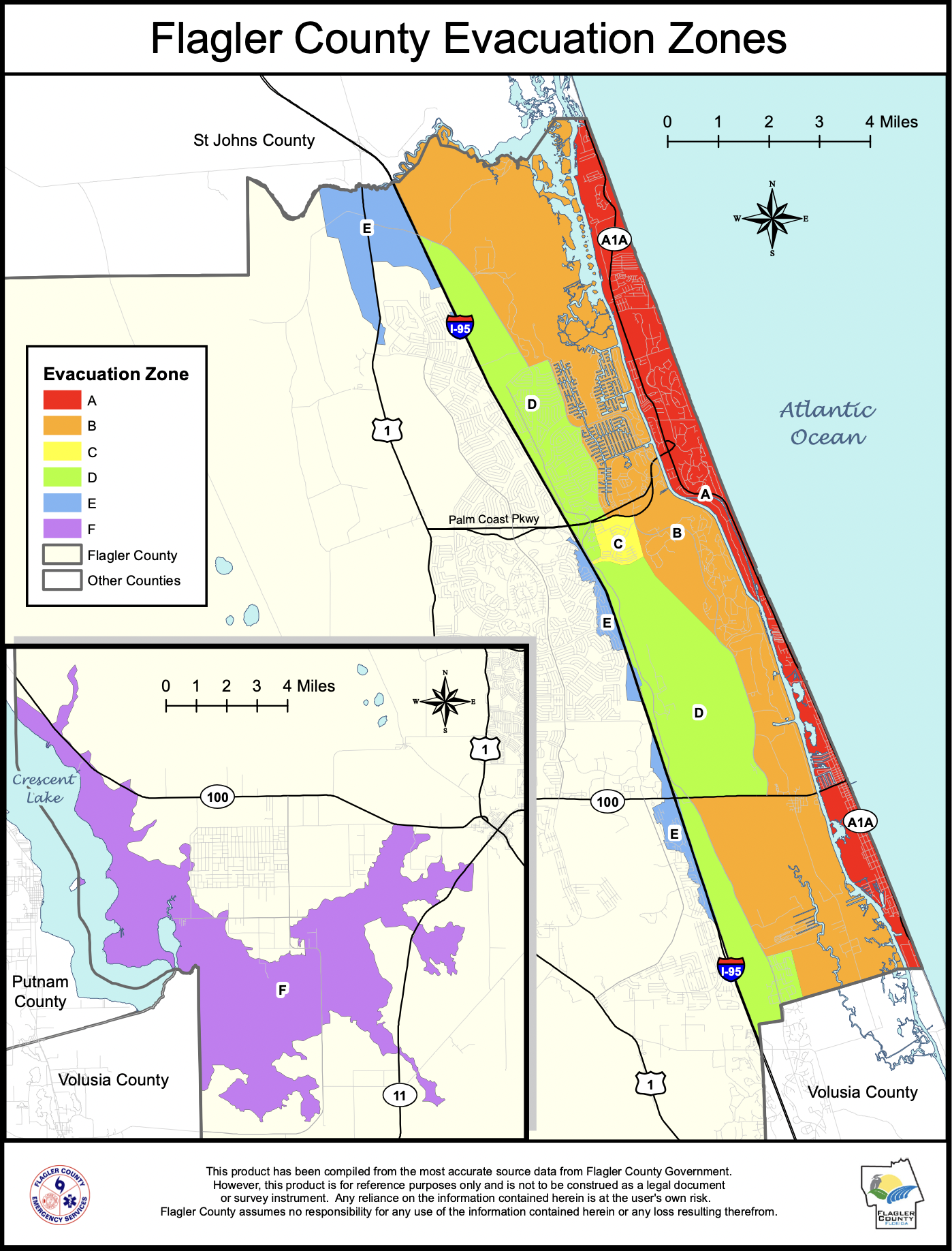
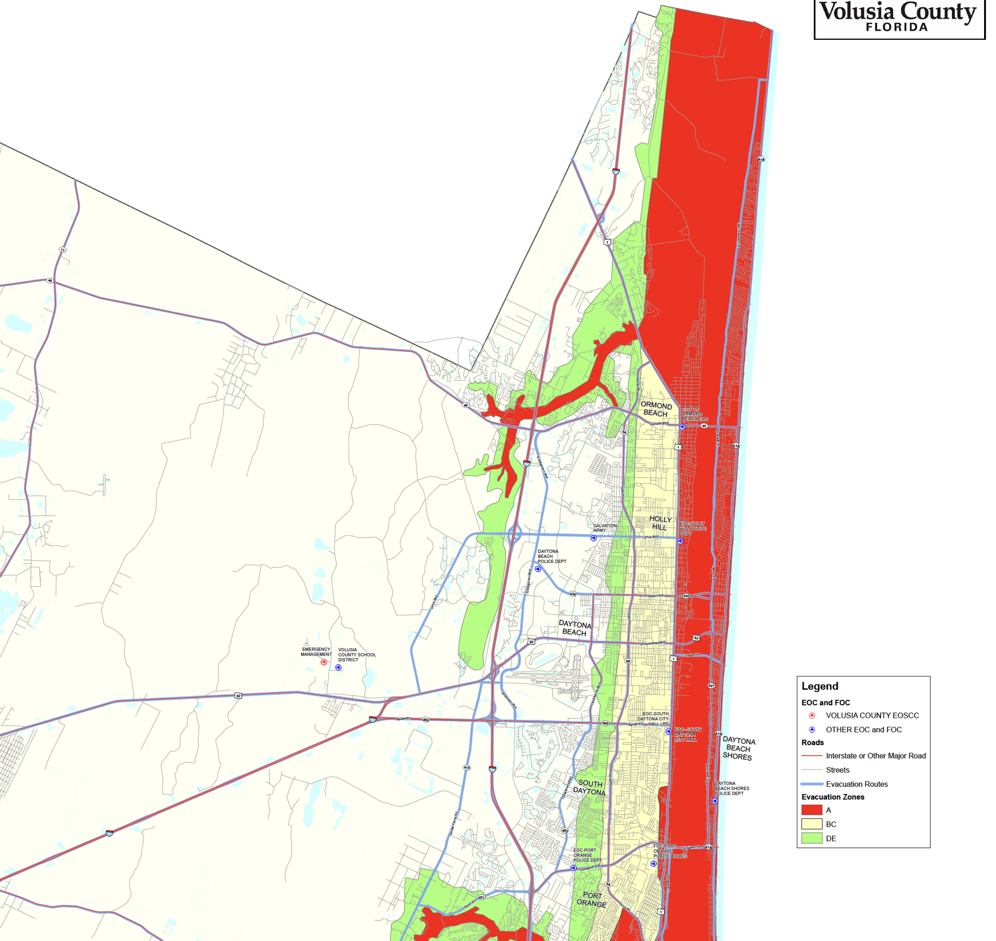
Flooding is a major concern for the Flagler-Volusia area, as the storm is expected to drop 10-15 inches of rain and interact with coastal conditions to drive storm surge.
Officials have warned residents to prepare for evacuation.
The Flagler-Volusia region could see tropical storm force winds as early as late afternoon Wednesday, but Wednesday evening is more likely. The storm itself is likely to pass the region in the early morning hours Friday.
For information on sandbags and preparation, click the links in the "Storm Preparation" box near the top of this story. Watch the Army Corps of Engineers video above for information on how to build flood barriers with sandbags and/or plywood.
Evacuation orders are expected.
Evacuation zone maps for Flagler and northern Volusia are below, or click HERE for an interactive Palm Coast/Flagler County evacuation zone map or HERE for an interactive Volusia County evacuation zone map.